“Four Corners” is named for the intersection of four states: Arizona, Utah, Colorado, and New Mexico. This confluence of states lies within the Colorado plateau, a large, generally mile-high, often mountainous plateau remarkable for past and current Indian habitation, for incredible scenery, and for many of our best national (and state) parks.
17-22 Sept: Grand Canyon –
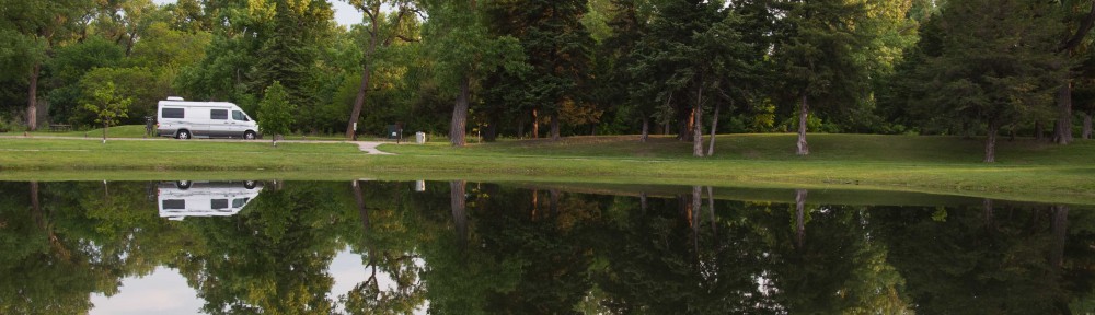
 We arrived late on the 17th (it is a 5-hr drive from the Phoenix area) and camped at the 10-mile National Forest Campground, just S of our destination.
  The next morning we hiked about 7.5 miles down the S. Kaibab Trail and then along the Tonto Trail east to “Cremation Canyon”. It was hot. As there was no water along that descent or in the side-canyon, we carried 11
  liters of water (at 2.2 lbs/l). My pack weighed 50 lbs and Judi’s was 30 lbs – too heavy! Beautiful and deserted on the Tonto Plateau. We camped at the “Cremation
  Hilton”, a small rocky overhang that has sheltered travelers for many centuries. We explored a bit, collapsed, and awoke quite sore. (It was cold during the night.) On the 19th we hiked another five miles to the
  canyon bottom, crossing the Colorado river on the black bridge to reach Bright Angel campground. (Fortunately, we had consumed food and almost all our water, lightening our packs.) The stream water was freezing – and felt
  great! Lots of life around camp – deer, lizards, dragonflies, a snake, and a fox carrying a ground squirrel. We hiked another mile north up the canyon, and then another mile on a loop trail over the Silver Bridge and along the river trail. The geology of the Grand Canyon is fascinating – and the rocks here at the bottom are 1.6-1.7 Billion years old. Incredible. Tuesday the 20th
  we awoke at 0400 and left camp at 0530 in a well-advised effort to “beat the heat” on our ascent. The hike to Indian Garden, the mid-
 point, was cool and fairly easy. We made it by 0900. Dave explored a small unmarked side-trail on the way, climbing up to nice Pueblo ruins along the cliff. Fortunately the trail up has three points with water. It gets steeper as one climbs though, and we shuffled slowly
 out at the top about 1:30 in the afternoon, eight hours of beautiful hiking. My pack weighed 33 lbs and Judi’s 18 lbs at the top – so we lost 30 lbs along the way, over 2/3 of it water. We camped on the S. rim the next two nights and to loosen up our very sore muscles, biked about 25 miles the day after our ascent. (Yes, we overdid it!)
22-24 Sept: G.C. to Zion –
Leaving the Grand Canyon, we drove east along the rim drive, stopping at old Indian ruins and the remarkable tower at Desert View. We then  drove through the Painted
 Desert and camped at Lee’s Crossing in Marble Canyon, surrounded by beautiful red rock formations overlooking the Colorado river. Great
  stars and some of the most beautiful vistas of any campsite we’ve visited. The next morning we drove down to the site where all Colorado river raft trips launch and back to the historic Navaho Bridge. Passing then beside colorful hills, we entered a corner of Vermillion Cliffs National Monument and stopped at a “condor overlook”,
  where one could just see a site where they are raised and released high in the cliffs. A couple from Stuttgart shared their impressive knowledge of the area with us, and we left on our
  bikes, heading for a 150 meter strip of petroglyphs along the cliff. Unfortunately we couldn’t reach them, but fortunately we weren’t badly injured in the attempt. It was beautiful, steep, and the hillsides were loose and treacherous. Great cacti and tumbleweeds. Incredible colors in the rocks. We will return here someday for further back-country exploration, but it requires a 4-wheel drive vehicle. We drove on and free-camped on a National Forest dirt road near the turn-off to the Grand Canyon north rim.
24-28 Sept: Zion National Park –
We left our campground early, spotting a large flock of turkeys on the road, and entered Zion with the masses. It was a “free day”. We camped in South Camping Ground for two nights, and the first day, took the shuttle to the Grotto, hiking the Watchman Trail and the upper and lower Emerald Pool trails. The mountains are incredible, but those trails were fairly crowded and unremarkable. A high
  point was seeing a tarantula along the trail! 🙂 On the 25th we hiked 5.4 miles to Angel’s Landing via the West Rim Trail. This is an all-time top-10 favorite trail! It is very steep and paved to the mid-point with great views. The top half
 of the trail snakes along a steep
  narrow ridge 1500 feet above the canyon, offering chains for handholds over many vertical cliff faces. Incredible views! After lunch we took the shuttle to the Temple of Sinewa, hiking a mile to the end of the paved trail and then 1/4 mile through the cold river till it got to the (4 ft.) deep place. We saved the all-day hike along this river for our next visit.
On the 26th, we drove an hour to a different and much-less visited section of Zion called Koleb Canyon. (It was great to talk to Mary Hamel by phone along the way, learning of her New England Journal publication on the initial success of the RTS,S malaria  vaccine that we had researched in Kenya!) We hiked about 6 miles on the LeVerkin Creek trail to a truly beautiful campsite (#6) overlooking red cliffs and a creek with a small waterfall. The water was so refreshing with built in massaging jets. Stars are great! After a lumpy night, we headed up-river the next morning, hiking first to a big arch less
  than a mile off the main trail. After lunch, we pushed on up stream and had a close
  encounter with a beautiful 4-5 foot rattlesnake. 🙂 The trail eventually petered out, and we bushwhacked on. Eventually we turned back and finally found the real trail. We followed it to a split and chose the wrong fork, hiking another 3/4 mile or so along the creek – so after 10 miles of quite tiring hiking, we never got to explore Bear Canyon. Next time. Dinner and a swim in our campsite waterfall were reviving, and we soon collapsed. On the 28th we hiked the steep 5.7 miles out, leaving beautiful towering red cliffs, cottonwoods, and wildflowers on a largely uphill trail. Lots of great exercise here.
28 Sept – 2 Oct: Bryce Canyon National Park – 
The drive between Zion and Bryce Canyon was incredible, passing through Cedar Breaks National Monument and surrounding hills near the height of their fall folliage display. We miss the Aspen trees, and this large dose of their colorful display was thrilling. Unfortunately, there were also huge mountainsides where every evergreen was dead, victims of the pine borer plague. Since they had already closed the campground for the winter (in late Sept!), we drove on to  Bryce Canyon, finding a site in Sunset Campground. On the 29th we hiked the beautiful Queen Anne’s trail from Sunrise Point. Incredible hoodoos and colors! In the afternoon, we drove slowly to Yovimpa and Rainbow Points at the
  south end of the park, pausing at several great overviews. We hiked the Bristlecone Loop trail only to find that the 1600 year old bristlecone pine we admired 12 years
  prior had succumbed to the same pine borer disease that is killing huge numbers of pines throughout the western U.S. 😦 On the drive back the sunset was phenomenal. The next day, 30 September, marked four months on this trip and, of much
  greater note, 27 years of a wonderful marriage. 🙂
Appropriately, we took another of our top-10 hikes. From  Sunset Point, we hiked the Navajo Loop and the adjoining Peekaboo Loop. Wow! About 6.4 miles of incredible views – followed that night by shrimp linguine in butter-lime sauce and topped by key-lime pie. This “camping food” can’t be beat!
On 1 October we left from Bryce Point on a 3-mile hike down the  Under-the-Rim trail t
 o West Fork Yellow Creek backcountry campground. This was a beautiful hike, particularly the stretch by the “Hat Shop”, colorful rock spires each capped by a stone “hat”. We carried 9 liters of water, but fortunately the hike was downhill and short. The campsite was beautiful, and we enjoyed hiking up and down the adjacent stream bed. The night was again cold at this
  elevation, but we were well prepared. We had a very nice hike back the next morning, and as we drove out of the park, prairie dogs and a beautiful Pronghorn antelope told us
  goodbye. We are particularly fond of this National Park, which inspired the name of our second son.
2-4 October: Kodachrome Basin State Park –
The drive east from Bryce Canyon traveled through beautiful country, colorful hills dotted with more hoodoo spires. We stopped briefly at the Grand Staircase Escalante National Monument visitors center (another park that is hard to explore without 4WD), and then drove on to the great Kodachrome Basin State Park campground. An evening  hike along the 1.5 mile Angel’s Palace loop trail was a bit damp (our first rain in months) but was a great vantage point to watch the sunset. Monday the 3rd started as laundry day. After lunch we biked the 6 mile Panorama Trail. Dave then hiked the 2.5 mile round trip to “Cool
  Cave” (not recommended) while, under gathering huge thunderclouds, Judi biked and hiked on to Shakespeare Arch. We then together biked the Grand Parade Trail, returning to our home as the
  rained started. After showers we had Steve O’Brien over for a nice cozy dinner in Leroy. (We met Steve on the backcountry trail at Bryce Canyon. He lives in Bend Oregon and has many similar interests. It was great to hear more about Bend.) We had heavy rains during the night, but the morning cleared, and we hiked the short Nature Trail before driving on.
4-6 Oct: Escalante to Capital Reef National Park –
From Kodachrome we drove to the booming town of Escalante, searching for a post office, printer, and fax machine. The town library was open for a couple of hours and provided a printer. There was no fax, but fortunately our iPhones can photograph and send documents – and there was phone reception at the center of town. The post office was closed in the afternoon so we drove back a few miles to Escalante Petrified State Park where we took a great two
  mile hike through the hills, seeing lots of big petrified logs with bright colors. We had another rainy night – and a cold front was closing fast. On the 5th, we returned to Hwy 12, leaving Escalante and driving by great rocky hills and overlooks. We passed the Escalante river and stopped at the Calf Creek Valley campground (full) to do a great 6-mile round trip hike to a 126 foot waterfall. There
 were a couple of small Indian graneries high in the cliffs but most impressive was the pictographs – Indian rock art with 3 larger-than-lifesize red Indians drawn on the far canyon wall. We also learned from fellow hikers what we had missed at the Escalante River trailhead so returned there, hiking up a small trail to find many Indian pictographs
  (painted rocks with goats, bird feet, and a panel with >100 white hand prints high on the canyon wall) and petroglyphs (chipped rock art) of four Indian figures. Unfortunately graffiti and vandalism have destroyed or marred much of this art, and the current Park Service defense is (understandably) to keep them hidden. Only selected and well-protected Indian art sites are now disclosed by park staff. We drove on,
 over the “hogback” – a “razorback ridge of slickrock” far above the adjacent canyons and winding creeks – to the town of Boulder, Utah where we took the Burr Trail Scenic Backway to a small (and full) BLM campground. It was cloudy, cold, and intermittently raining all day so we drove back to a large parking area off the road and free camped
  for the night. Fortunately we didn’t get the predicted snow. We had a nice breakfast in Bolder Utah while the sleet passed and
  then drove up Hwy 12 to the Anasazi State Park museum, housing some artifacts and the foundations of a 15-20 room settlement. Once the temperature rose a few more degrees and the snow plows
  had done their work, we continued on Hwy12 over the mountains. This was a BEAUTIFUL drive. The aspen were a bit past-peak but
  many still sported their fall folliage, there was snow on the ground, the clouds were dark and threatening, and occaisionally the sun broke through to illuminate incredible overviews.
6-8 Oct: Captal Reef National Park –
Leaving the mountains and snow behind, we drove on to Capital Reef. After getting a campsite, we drove out the 10 mile scenic drive, stopping at the end to hike down a wide canyon. We searched for but could not find petroglyphs. However, graffiti in one area was from 1884 – within 5 years of the first Mormon settlers to the area.  Returning to the main valley, we enjoyed picking ($1/lb) apples in one of the prior settler’s orchards. The next morning, we used the gas heater in our camper to ease us out of bed. (It was getting cold – time to turn south soon.) We stopped by the Pioneer house at 0800 to buy a blackberry pie, and then left from the campground on an incredible 12.5 mile hike. We
  climbed the adjacent mountain, hiking down Cohab Canyon and up to great viewpoints over the valley. We
  then hiked along the long, beautiful Frying Pan Trail, going up and down mountains, through washes, … We hiked out to Cassidy Arch, a large arch high in the rocks above the valley, where we ate our peanut butter sandwiches and blackberry pie. We then
  descended to the Grand Wash Trail, hiking through “The Narrows” with mountains above us on both sides. One is warned not to hike through this area if rain is imminent as it commonly floods and escape for hikers is wet and difficult. This cut-through left us several miles down the road and short of time to reach the 3 p.m. petroglyph ranger talk – but
  fortunately we were able to ride the last half-mile with a heavily armed park ranger (their guns seem to be getting bigger over the years). The Indian petroglyphs here are very interesting and less vandalized. We hiked the remaining half-mile back to camp; tired, but what an incredible day. After cold
  showers in 50 degree weather, driving down the road in search of phone reception warmed our home, and hot chile for supper warmed us further. The next morning we explored the cliff downstream from the petroglyph panel that is on the map and “open” to the public – and found
  more and more petroglyphs – figures, animals, spirals, etc. We picked more apples in a field with wild turkeys and then hiked a 2.2 mile round trip trail to Hickman Bridge, a 133 foot rock bridge.
  Nice overviews and a Freemont Indians
  grainery along the trail. Driving on, we had lunch at another roadside grainery on the east side of the park. (The Indians in the area used these to store food.)
8-9 Oct: Goblin Valley State Park –
From Capital Reef we turned north briefly to visit a nearby state park that was highly recommended. The campground was full but we were able to free camp at a large BLM parking lot (with clean potties) seven miles back. We took a nice hike in the rocky hills that evening. On the 9th we visited Goblin Valley State Park, hiking 
 about 3 miles around a landscape full of interestingly eroded rock and dirt formations. The park got its name because, to some, these hoodoo formations look like goblins – and this small park has recently been
  the site of several movies that capitalize on this striking topograph. As we left, the park warden told us of nearby petroglyphs and so we stopped by these large but badly
  vandalized panels, just a half-mile from our prior night’s campground.
Back on the road and heading north (but wanting to go south), we looped (briefly) into Colorado on a quite remote stretch of I-70. As this marked the top or northernmost point of our “Four Corners” circumnavigation, and as this current posting is more than long enough, it is a good place to stop – to be continued….

I think you two have seen more of my home state in these past few months than I have in my life. 😉 I’m glad you find it as beautiful as I do. Nice rattler photo!
What an incredible area!
Hope you guys are doing well in your schools, staying warm, and having fun
🙂 Dave
loving your strories and pictures