9 Oct – 3 Nov: Completing our 4 Corners circuit

Our prior post detailed the NW half of our 4 Corners circuit, capturing visits to the Grand Canyon, Zion, Bryce Canyon, Capital Reef, as well as multiple National Monuments and state parks en route. Turning south when we reached I-70 in Utah, we gradually moved toward warmer weather…

9-11 Oct: Canyonlands N.P. –
The Canyonlands campground was full – as was that at the adjacent state park – so we found a nice BLM site, Cowboy Campground, just down the road.  Water is scarce here, delivered by truck to these parks, but we were able to fill our containers at the National Park. It is beautiful, but nights are almost freezing.  On the 10th we drove to adjoining Dead Horse State Park as we were told (incorrectly) that camping might be available.  We toured their great visitors center displays and took a nice 3 mile hike, learning about the fascinating primative but complex little creatures that live in transient water holes in the rocks.   Great canyon views too!  We then drove into Canyonlands NP “Island in the Sky” section, stopping at several overlooks, taking a short hike to Mesa Arch, and hiking about 2 miles round trip to the 2nd lookout over Upheaval Dome. On the way back to our $8/night BLM campsite, we strolled around Grand View and Sunset Points – with quite a view over the surrounding canyons.

11-14 Oct:  Arches N.P and Moab –
We drove into Moab early the next morning and found an RV park by the Colorado river. We shopped, washed clothes and the van, took warm showers, and generally had a leisurely day.  On the 12th we visited Arches, stopping by several view points with short hikes on our drive 8.5 miles out a gravel road in “Salt Valley”  There we hiked 3.4 miles r.t. to Tower Arch.  A dozen other hikers had picnic lunches with us under the arch. Beautiful. Next we drove back to the Windows Section and saw Double Arch, Turret Arch, and the N. and S. Windows arches on about a 1.5 mile hike.  To cap the day, we drove to the Delicate Arch parking lot and hiked 100 ft to Wolfe Ranch and a nice panel of Ute petroglyphs – men on horses….We hike on, a busy 3 mile r.t. trail, to Delicate Arch and joined an entertaining throng of onlookers who watched and photographed the sunset and Arch before we all walked quickly back through the gathering gloam.  The next day we went in search of the Courthouse Wash Rock Art, driving down the road and then  hiking back to find it just across the road from our campground.  It is very faded (badly vandalized) but contains older large figures in the Barrier Canyon style; archaic, ghost-like (some say martian-like?) red painted figures.  The panel also had rock-art figures from a later period along with superimposed warrior shields from the Ute Indian time and unfortunately significant graffiti from our latest period as well.  We then drove back into Arches N.P. to the Devil’s Garden Trailhead and hiked the roughly 8 mile loop trail by at least seven great arches, visiting them all.  This is a superb hike.  The trail led over long rock fins with drop-offs on both sides, the rock formations and vistas were incredible, and the return hike had some very nice scrambling on a tougher trail.  Can you see Judi on the rock fin over the arch in the photo below?  After re-joining the main trail, we were fortunate to see a small rattlesnake (pygmy or juvenile?) crossing the trail.  We next hiked to Sand Dunes Arch – an interesting 1/3 mile walk between rocky fins with adjacent sand drifts.  I hiked on another 1.3 miles r.t to Broken Arch, spotting lizards but no other snakes.  On our return drive, we stopped by the Balanced Rock and then by Park Avenue before leaving the park and driving 5 miles down the nearby Rt. 279 (Potash Rd.).  This brought us to a 125 foot long panel of Indian rock art from the Formative Period – paperdoll cutouts, horned figures with shields, etc.  Two hundred feet further down the road were more, including a large bear with 3 small hunters wielding spears around it.  Another 3/4 mile brought us to more petroglyphs and also Dinosaur Tracks!  Tracks of Allosaurus, a 3-toed dinosaur, which included both imprints on one rock and the reverse 3-toed protrusions on an adjacent rock.  These are at the Navajo/Kayenta sandstone interface and apparently another half-dozen carnivorous dinosaurs also left their tracks on that hillside (but we couldn’t find them). The next morning we continued our Moab Indian rock-art tour, visiting among several others, the incredible “Birthing Scene” rock (below R) on the other side of the river and, on the way out of town, the “Moab Man” pictured at left.

14-16 Oct: Hovenweep N.M. –
Ancestral Pueblo Indians (previously called Anasazi) built small groups of stone buildings and towers around the ravines in this area mainly between 1200-1300 A.D.  The main group of structures are called Square Tower after a prominent central structure, and we started our exploration with the 1.5 mile hike around this area that  encompasses about 10 fairly small ruins. (This trail passed by the campground, and Dave returned for the next two mornings to hike the circuit at sunrise.)  On the 15th we took a ranger-led tour off the permitted trail to a small group of petroglyphs that included 3 macaws, colorful birds that never flew within hundreds of miles of Hovenweep but were imported in early Indian trade.  After lunch we took an ambitious 25 mile bike ride (the first 12 miles uphill) to visit the small ruins at the former communities of Holly, Horseshoe, Hackberry, and Cutthroat Castle. Each of these sites had interesting old stone buildings and towers, some perched on large boulders in the ravine. Our ride back was long, fast, and increasingly dark.  After a quick supper, we attended a great astronomy program led by an energetic and engaging ranger.  We saw the Andromeda galaxy and its resident binary star, 4 of the moons and 2 bands on Jupiter, and close-ups of our moon.  The next morning we drove to and hiked around the remaining Hovenweep community of ruins, named Cajon, before driving on.

16-17 Oct: Mesa Verde NP and Aztec NM –
After a quick half mile hike in the Canyon of the Ancients near Castle Rock, we drove on to Mesa Verde, arriving after lunch.  The Aspen, Cottonwood and Oak trees along the way put on quite a show with their yellow and orange leaves.  Most of Mesa Verde was closed for the season, but we quickly hiked the self-guided trail through Spruce Tree House, took the 1600 (last) ranger-guided tour of Cliff Palace, and drove the 6-mile Mesa Top Loop, stopping at each site to see ruins that illustrated the evolution of the Ancestral Pueblo architecture and culture.  Spruce Tree House and Cliff Palace are both incredible.  Stabilized and and partially rebuilt, they well capture the magnitude and beauty of these villages that were built below towering cliffs.   One isn’t alone and doesn’t get the sense of Hovenweep’s small, quiet, abandoned ruins in their natural setting – but these Mesa Verde ruins are much larger and more impressive. Leaving with an incredible sunset, we struck out with nearby camping, eventually driving into the nearby National Forest to free camp by a logging road.  On the 17th, we had a can’t-be-beat pancake breakfast at a diner in the cute town of Mancos CO before driving through a beautiful aspen-laced valley to Durango.  We pulled in just as the morning train left and took a nice stroll around town, looking also at the cute residential areas.  Seeing the wintertime temperatures and snowfall, we drove quickly on, heading south into New Mexico.  Stopping at Aztec National Monument, we took their self-guided tour (with a nice booklet) through a huge, partially excavated Ancestral Pueblo site containing about 500 rooms with low ceilings and lower doors.  (And there was an adjacent, unexcavated site of similar size!)  In addition to the impressive size of the ruins, most noteworthy was a restored giant kiva.  All Ancestral Pueblo ruins are associated with one or often many underground kivas, and while their structure evolved some over time, they all had a central firepit and were entered from the top by way of a ladder (through the smoke).  Serving religious but also probably many functions, each family unit had a kiva – but these Giant Kivas were impressive common meeting and “worship?” places where key members of their communities could gather.

17-20 Oct: Chaco Cultural National Historic Park –
Continuing our Indian Ruins tour, we drove on to Chaco National Historic Park, slowly driving the last 10 miles over a rough dirt road that rattled our camper and bones – and cracked our windshield.  Chaco is a World Heritage Site, and was at the heart of the Ancestral Puebloan world for several hundred years.  We camped for three nights in a unique campground with cliff dwelling ruins just 50 feet from our site.  The first evening we took a one mile r.t. hike to the unexcavated (or re-covered) Una Vida site (150 rooms, 5 kivas) and saw some great petroglyphs.  We then drove the 9 mile loop road, seeing huge ruins and about a dozen elk.  On the 18th we took a morning guided tour of Pueblo Bonito, the largest of about 150 Chacoan great houses in the Four Corners area.  Impressive!  While it was originally thought that these great houses were huge apartment buildings, it is now felt they were more like community centers and temples, serving as major sites of community ceremonies as well as storage, trading, and communication.  Pueblo Bonito was built between 850-1150 A.D. and was at least 4 stories tall with over 600 rooms and 40 kivas!  We then hiked a nice petroglyph trail to the adjacent Chetro Ketl great house, the 2nd largest that was also at least 4 stories and had 500 rooms.  These two huge structures were built with large open courtyards and seemed to overlap.  We next drove to another great house a few miles down the road, Pueblo del Arroyo, that was closed for repairs.  From there we biked to a smaller (100 room, 5 kiva) great house called Kin Kletso and then on to Casa Chiquita, a similar sized great house built around AD 1060.  At the end of that 1 mile trail, we hike another 5.5 miles r.t., first to the “Supernova” pictograph site and then on to Penasco Blanco, another huge great house situated on the mesa above the canyon but with a perfect line-of-site to Pueblo Bonito.  (You get the idea; there are many huge ruins that are largely unexcavated.)  That evening we attended a great lecture on the astrology of the Chacoans, learning how they aligned structures to within 1 degree of true N-S and E-W directions and placed markers on their buildings to signal events like the winter and summer solstices.  Really impressive – and great stars!  Chaco is far from any city lights (or cell phone reception) and is the only N.M. with its own observatory!  The next morning it was 31degrees  when we got up – brrr.  We drove back to Pueblo del Arroyo, biked to Kin Kletso, and took the Pueblo Alto Trail, ascending to the upper plateau through a crack in the rocks filled with rubble just as the Chacoans did 1000 years prior.  We hiked over rocks that were once at the bottom of an ancient sea and contained many unusual fossils including thousands of branching tubes (“shrimp burrows” according to the park).  We walked through New Pueblo, a smallish residential structure of probably <100 rooms, and then across a field to Pueblo Alto, another huge unexcavated great house.  The Chacoans used to break pottery as part of their religious offering, and in places, the ground was littered with pottery shards.  Walking on sections of old Chacoan roads (that fanned out from Pueblo Bonito in all directions), we hiked by a large Chacoan stairway, chipped in the rock and climbing a cliff to the mesa.  This one originally had hand rails. The loop trail followed an old Chacoan “highway” along the mesa cliff-top, past circles of stones and great vistas of the great house ruins below.  After lunch we looked at more petroglyphs, hiked through more ruins including an excavated Giant Kiva, and biked the 3 mile r.t Wijiji trail from our campground to another unexcavated (3-story, 225 room) great house.  What a fascinating and impressive place!

20-28 Oct: The Santa Fe N.M. area –
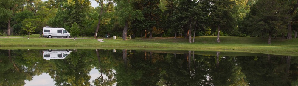
We drove from Chaco to Santa Fe and camped in an RV park near Eldorado, a planned subdivision about 10 miles SE of Santa Fe that is reportedly the largest solar community in the nation.  On the 21st we drove through Eldorado, walked around the old town square in Santa Fe, and then descended on Dr. Richard Andre, one of our former USUHS professors.  Dr. Andre is an Entomologist who worked closely with Judi in Peru as she did her DrPH research on Bartonella Bacilliformis.  He and his wife (who was travelling in Asia with her work) live in a beautiful house above Santa Fe, and we firmly ensconced ourselves in their beautiful Guest House.  Over the next week we ate countless gourmet meals, met his delightful and very interesting neighbors, took the birdfeeders down at dusk to protect them from the neighborhood bears and put them back out in the morning, and took several hikes: to town for tea, 3.5 miles r.t. into the trails above the Audubon Society, and a hike of similar distance in the Carson National Forest 20 minutes away. On the 24th we visited Bandelier N.M., viewing small caves in the volcanic cliffs, petroglyphs, remains of cliff dwellings, and interesting ruins of a 350 room circular stone town. At a second site there were more caves, ruins, petroglyphs, and most impressive were deep paths in the soft volcanic rock that were worn down over many years by the prior inhabitants. The following day we toured about 10 houses in Eldorado with a realtor.  There is little active solar but some of the houses are built with a passive solar design that warms them in the winter.  Nice – but not entirely sold.  The 26th was cold and rainy but undaunted, we took a beautiful drive with Dr. Andre to Taos, stopping along the way to see highlights in several small towns.  In Taos we visited the church, strolled through the quaint downtown area, and touring the Earthship Project.  While these largely underground, stand-alone Earthships are built with unusual materials and display some questionable workmanship, they do incorporate some fascinating technologies and ideas (like capturing rain water and then reusing all water 3 times).   The following day we all visited the Santa Fe Folk Museum, and in the afternoon, Judi and I drove to Los Alamos and toured the very impressive Bradbury Science museum.  With our clothes getting tight, we ate a final gourmet breakfast on the 28th and then left Dr. Andre and his wonderful hospitality, heading south.

28-29 Oct: Petroglyphs N.M. –
We stopped in Albuquerque at Petroglyphs N.M., planning to hike through and head on.  However, we discovered there were three different sections of the monument, all with trails along volcanic basalt boulder strewn cliffs with incredible petroglyphs – and we had become quite interested in this Indian rock art.  On the 28th we hiked Riconada Canyon but didn’t have time to hike the two other nearby sections – so we camped at nearby Kirkland AFB and returned the next morning, hiking both Boca Negra and Piedras Macadra Canyons.  Each of these trails is about 1.5 miles long and passes by large numbers of interesting Indian rock art chipped pictures as well as some Spanish graffiti.

29-31 Oct: Bosque del Apache National Wildlife Refuge:
Leaving our petroglyphs, we drove south to Bosque, camping at a small RV park run by an aging couple outside the park.  While we were a few weeks early (most migratory birds arrive in mid to later November), we saw large numbers of snow geese, greater sandhill cranes, and northern pintail ducks along with isolated western grebe, northern harrier hawks, Gamble quail, a roadrunner….  Sunrises were particularly impressive with huge flocks of snow geese feeding and then suddenly rising together and departing for their daytime appointments.  Coyotes would trot out at the edges of the marsh, not too far from the wary birds and would intermittently send out a lonesome call.  We took a windy 12 mile bike ride but the wildlife is much more wary when one is outside of ones car.

31 Oct – 3 Nov: Saguaro National Park in Tucson –
Leaving the Bosque after the sunrise show, we stopped briefly in Wilcox AZ to see four lesser sandhill cranes and a few other waterbirds.  The lesser sandhill cranes fly here from their nesting grounds in Alaska, but we were 
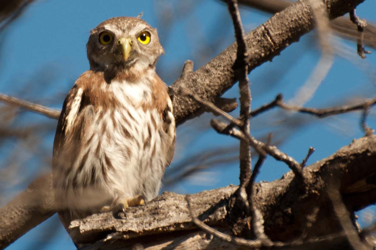
also early here – and a more extensive search for them would have taken us far afield.  We drove on to Tucson and camped for a couple of nights at Davis-Monthan AFB, voted the #1 military RV park for many years.  This is a huge park, and they get large numbers of “snow-birds” (the non-feathered varitey) who arrive en-masse spend months here.  Most arrive soon after the Christmas holidays.  We really have enjoyed military base exercise facilities, and these were particularly good with indoor pool.  On 1 Nov we drove about 5 miles to Saguaro N.P. East and drove their loop drive, stopping to do a couple of very nice hikes.  We were early for the migrant birds but enjoyed the incredible cacti and year-round resident wildlife.  The following day we drove through Tucson to Saguaro National Park West.  Again, we did their drive through the park and stopped to hike a bit.  The saguaros were a bit smaller but more numerous in this eastern part of the park.  After exploring for a few hours, we drove back to Phoenix, beating rush-hour and completing our long 4-corners circuit.

17 Sept – 9 Oct: The first half of our Four Corners loop

“Four Corners” is named for the intersection of four states: Arizona, Utah, Colorado, and New Mexico.  This confluence of states lies within the Colorado plateau, a large, generally mile-high, often mountainous plateau remarkable for past and current Indian habitation, for incredible scenery, and for many of our best national (and state) parks.

17-22 Sept: Grand Canyon –
We arrived late on the 17th (it is a 5-hr drive from the Phoenix area) and camped at the 10-mile National Forest Campground, just S of our destination.  The next morning we hiked about 7.5 miles down the S. Kaibab Trail and then along the Tonto Trail east to “Cremation Canyon”.  It was hot.  As there was no water along that descent or in the side-canyon, we carried 11 liters of water (at 2.2 lbs/l).  My pack weighed 50 lbs and Judi’s was 30 lbs – too heavy!  Beautiful and deserted on the Tonto Plateau.  We camped at the “Cremation Hilton”, a small rocky overhang that has sheltered travelers for many centuries.  We explored a bit, collapsed, and awoke quite sore.  (It was cold during the night.)  On the 19th we hiked another five miles to the canyon bottom, crossing the Colorado river on the black bridge to reach Bright Angel campground. (Fortunately, we had consumed food and almost all our water, lightening our packs.)  The stream water was freezing – and felt great!  Lots of life around camp – deer, lizards, dragonflies, a snake, and a fox carrying a ground squirrel.  We hiked another mile north up the canyon, and then another mile on a loop trail over the Silver Bridge and along the river trail.  The geology of the Grand Canyon is fascinating – and the rocks here at the bottom are 1.6-1.7 Billion years old.  Incredible.  Tuesday the 20th we awoke at 0400 and left camp at 0530 in a well-advised effort to “beat the heat” on our ascent.  The hike to Indian Garden, the mid-point, was cool and fairly easy.  We made it by 0900.  Dave explored a small unmarked side-trail on the way, climbing up to nice Pueblo ruins along the cliff.  Fortunately the trail up has three points with water.  It gets steeper as one climbs though, and we shuffled slowly out at the top about 1:30 in the afternoon, eight hours of beautiful hiking.  My pack weighed 33 lbs and Judi’s 18 lbs at the top – so we lost 30 lbs along the way, over 2/3 of it water.   We camped on the S. rim the next two nights and to loosen up our very sore muscles, biked about 25 miles the day after our ascent.  (Yes, we overdid it!)

22-24 Sept: G.C. to Zion –
Leaving the Grand Canyon, we drove east along the rim drive, stopping at old Indian ruins and the remarkable tower at Desert View.  We then drove through the Painted Desert and camped at Lee’s Crossing in Marble Canyon, surrounded by beautiful red rock formations overlooking the Colorado river. Great stars and some of the most beautiful vistas of any campsite we’ve visited. The next morning we drove down to the site where all Colorado river raft trips launch and back to the historic Navaho Bridge.  Passing then beside colorful hills, we entered a corner of Vermillion Cliffs National Monument and stopped at a “condor overlook”, where one could just see a site where they are raised and released high in the cliffs.  A couple from Stuttgart shared their impressive knowledge of the area with us, and we left on our bikes, heading for a 150 meter strip of petroglyphs along the cliff. Unfortunately we couldn’t reach them, but fortunately we weren’t badly injured in the attempt. It was beautiful, steep, and the hillsides were loose and treacherous.  Great cacti and tumbleweeds.  Incredible colors in the rocks. We will return here someday for further back-country exploration, but it requires a 4-wheel drive vehicle. We drove on and free-camped on a National Forest dirt road near the turn-off to the Grand Canyon north rim.

24-28 Sept:  Zion National Park –
We left our campground early, spotting a large flock of turkeys on the road, and entered Zion with the masses. It was a “free day”.  We camped in South Camping Ground for two nights, and the first day, took the shuttle to the Grotto, hiking the Watchman Trail and the upper and lower Emerald Pool trails.  The mountains are incredible, but those trails were fairly crowded and unremarkable.  A high point was seeing a tarantula along the trail!  🙂  On the 25th we hiked 5.4 miles to Angel’s Landing via the West Rim Trail.  This is an all-time top-10 favorite trail!  It is very steep and paved to the mid-point with great views.  The top half of the trail snakes along a steep narrow ridge 1500 feet above the canyon, offering chains for handholds over many vertical cliff faces. Incredible views!   After lunch we took the shuttle to the Temple of Sinewa, hiking a mile to the end of the paved trail and then 1/4 mile through the cold river till it got to the (4 ft.) deep place.   We saved the all-day hike along this river for our next visit.
On the 26th, we drove an hour to a different and much-less visited section of Zion called Koleb Canyon.  (It was great to talk to Mary Hamel by phone along the way, learning of her New England Journal publication on the initial success of the RTS,S malaria vaccine that we had researched in Kenya!)   We hiked about 6 miles on the LeVerkin Creek trail to a truly beautiful campsite (#6) overlooking red cliffs and a creek with a small waterfall.  The water was so refreshing with built in massaging jets. Stars are great!  After a lumpy night, we headed up-river the next morning, hiking first to a big arch less than a mile off the main trail.  After lunch, we pushed on up stream and had a close encounter with a  beautiful 4-5 foot rattlesnake.  🙂  The trail eventually petered out, and we bushwhacked on.  Eventually we turned back and finally found the real trail.  We followed it to a split and chose the wrong fork, hiking another 3/4 mile or so along the creek – so after 10 miles of quite tiring hiking, we never got to explore Bear Canyon.  Next time.  Dinner and a swim in our campsite waterfall were reviving, and we soon collapsed. On the 28th we hiked the steep 5.7 miles out, leaving beautiful towering red cliffs, cottonwoods, and wildflowers on a largely uphill trail.  Lots of great exercise here.

28 Sept – 2 Oct:  Bryce Canyon National Park – 
The drive between Zion and Bryce Canyon was incredible, passing through Cedar Breaks National Monument and surrounding hills near the height of their fall folliage display.  We miss the Aspen trees, and this large dose of their colorful display was thrilling.  Unfortunately, there were also huge mountainsides where every evergreen was dead, victims of the pine borer plague.  Since they had already closed the campground for the winter (in late Sept!), we drove on to Bryce Canyon, finding a site in Sunset Campground.  On the 29th we hiked the beautiful Queen Anne’s trail from Sunrise Point.  Incredible hoodoos and colors!  In the afternoon, we drove slowly to Yovimpa and Rainbow Points at the south end of the park, pausing at several great overviews.  We hiked the Bristlecone Loop trail only to find that the 1600 year old bristlecone pine we admired 12 years prior had succumbed to the same pine borer disease that is killing huge numbers of pines throughout the western U.S.  😦   On the drive back the sunset was phenomenal.  The next day, 30 September, marked four months on this trip and, of much greater note,  27 years of a wonderful marriage.   🙂
Appropriately, we took another of our top-10 hikes.  From Sunset Point, we hiked the Navajo Loop and the adjoining Peekaboo Loop.  Wow!  About 6.4 miles of incredible views – followed that night by shrimp linguine in butter-lime sauce and topped by key-lime pie.  This “camping food” can’t be beat!
On 1 October we left from Bryce Point on a 3-mile hike down the Under-the-Rim trail to West Fork Yellow Creek backcountry campground.  This was a beautiful hike, particularly the stretch by the “Hat Shop”, colorful rock spires each capped by a stone “hat”.  We carried 9 liters of water, but fortunately the hike was downhill and short.  The campsite was beautiful, and we enjoyed hiking up and down the adjacent stream bed. The night was again cold at this elevation, but we were well prepared.  We had a very nice hike back the next morning, and as we drove out of the park, prairie dogs and a beautiful Pronghorn antelope told us goodbye. We are particularly fond of this National Park, which inspired the name of our second son.

2-4 October: Kodachrome Basin State Park –
The drive east from Bryce Canyon traveled through beautiful country, colorful hills dotted with more hoodoo spires.  We stopped briefly at the Grand Staircase Escalante National Monument visitors center (another park that is hard to explore without 4WD), and then drove on to the great Kodachrome Basin State Park campground.  An evening hike along the 1.5 mile Angel’s Palace loop trail was a bit damp (our first rain in months)  but was a great vantage point to watch the sunset.  Monday the 3rd started as laundry day.  After lunch we biked the 6 mile Panorama Trail.  Dave then hiked the 2.5 mile round trip to “Cool Cave” (not recommended) while, under gathering huge thunderclouds, Judi biked and hiked on to Shakespeare Arch.  We then together biked the Grand Parade Trail, returning to our home as the rained started. After showers we had Steve O’Brien over for a nice cozy dinner in Leroy.  (We met Steve on the backcountry trail at Bryce Canyon.  He lives in Bend Oregon and has many similar interests.  It was great to hear more about Bend.)   We had heavy rains during the night, but the morning cleared, and we hiked the short Nature Trail before driving on.

4-6 Oct: Escalante to Capital Reef National Park –
From Kodachrome we drove to the booming town of Escalante, searching for a post office, printer, and fax machine.  The town library was open for a couple of hours and provided a printer.  There was no fax, but fortunately our iPhones can photograph and send documents – and there was phone reception at the center of town.  The post office was closed in the afternoon so we drove back a few miles to Escalante Petrified State Park where we took a great two mile hike through the hills, seeing lots of big petrified logs with bright colors.  We had another rainy night – and a cold front was closing fast.  On the 5th, we returned to Hwy 12, leaving Escalante and driving by great rocky hills and overlooks.  We passed the Escalante river and stopped at the Calf Creek Valley campground (full) to do a great 6-mile round trip hike to a 126 foot waterfall.  There were a couple of small Indian graneries high in the cliffs but most impressive was the pictographs – Indian rock art with 3 larger-than-lifesize red Indians drawn on the far canyon wall.  We also learned from fellow hikers what we had missed at the Escalante River trailhead so returned there, hiking up a small trail to find many Indian pictographs (painted rocks with goats, bird feet, and a panel with >100 white hand prints high on the canyon wall) and petroglyphs (chipped rock art) of four Indian figures.  Unfortunately graffiti and vandalism have destroyed or marred much of this art, and the current Park Service defense is (understandably) to keep them hidden.  Only selected and well-protected Indian art sites are now disclosed by park staff.  We drove on, over the “hogback” – a “razorback ridge of slickrock” far above the adjacent canyons and winding creeks – to the town of Boulder, Utah where we took the Burr Trail Scenic Backway to a small (and full) BLM campground.  It was cloudy, cold, and intermittently raining all day so we drove back to a large parking area off the road and free camped for the night.  Fortunately we didn’t get the predicted snow.  We had a nice breakfast in Bolder Utah while the sleet passed and then drove up Hwy 12 to the Anasazi State Park museum, housing some artifacts and the foundations of a 15-20 room settlement. Once the temperature rose a few more degrees and the snow plows had done their work, we continued on Hwy12 over the mountains.  This was a BEAUTIFUL drive.  The aspen were a bit past-peak but many still sported their fall folliage, there was snow on the ground, the clouds were dark and threatening, and occaisionally the sun broke through to illuminate incredible overviews.

6-8 Oct: Captal Reef National Park –
Leaving the mountains and snow behind, we drove on to Capital Reef.  After getting a campsite, we drove out the 10 mile scenic drive, stopping at the end to hike down a wide canyon.  We searched for but could not find petroglyphs.  However, graffiti in one area was from 1884 – within 5 years of the first Mormon settlers to the area. Returning to the main valley, we enjoyed picking ($1/lb) apples in one of the prior settler’s orchards. The next morning, we used the gas heater in our camper to ease us out of bed.  (It was getting cold – time to turn south soon.)  We stopped by the Pioneer house at 0800 to buy a blackberry pie, and then left from the campground on an incredible 12.5 mile hike.  We climbed the adjacent mountain, hiking down Cohab Canyon and up to great viewpoints over the valley.  We then hiked along the long, beautiful Frying Pan Trail, going up and down mountains, through washes, …  We hiked out to Cassidy Arch, a large arch high in the rocks above the valley, where we ate our peanut butter sandwiches and blackberry pie.  We then descended to the Grand Wash Trail, hiking through “The Narrows” with mountains above us on both sides. One is warned not to hike through this area if rain is imminent as it commonly floods and escape for hikers is wet and difficult.  This cut-through left us several miles down the road and short of time to reach the 3 p.m. petroglyph ranger talk – but fortunately we were able to ride the last half-mile with a heavily armed park ranger (their guns seem to be getting bigger over the years).  The Indian petroglyphs here are very interesting and less vandalized.  We hiked the remaining half-mile back to camp; tired, but what an incredible day.  After cold showers in 50 degree weather, driving down the road in search of phone reception warmed our home, and hot chile for supper warmed us further.  The next morning we explored the cliff downstream from the petroglyph panel that is on the map and “open” to the public – and found more and more petroglyphs – figures, animals, spirals, etc.  We picked more apples in a field with wild turkeys and then hiked a 2.2 mile round trip trail to Hickman Bridge, a 133 foot rock bridge.  Nice overviews and a Freemont Indians grainery along the trail.  Driving on, we had lunch at another roadside grainery on the east side of the park.  (The Indians in the area used these to store food.)

8-9 Oct: Goblin Valley State Park –
From Capital Reef we turned north briefly to visit a nearby state park that was highly recommended.  The campground was full but we were able to free camp at a large BLM parking lot (with clean potties) seven miles back.  We took a nice hike in the rocky hills that evening.  On the 9th we visited Goblin Valley State Park, hiking about 3 miles around a landscape full of interestingly eroded rock and dirt formations.  The park got its name because, to some, these hoodoo formations look like goblins – and this small park has recently been the site of several movies that capitalize on this striking topograph.  As we left, the park warden told us of nearby petroglyphs and so we stopped by these large but badly vandalized panels, just a half-mile from our prior night’s campground.

Back on the road and heading north (but wanting to go south), we looped (briefly) into Colorado on a quite remote stretch of I-70.  As this marked the top or northernmost point of our “Four Corners” circumnavigation, and as this current posting is more than long enough, it is a good place to stop – to be continued….

Heading S to Phoenix: 24 Aug – 17 Sept

24-26 August: Lassen Volcanic NP –
We drove S from LaPines State Park in Oregon to Lassen Volcanic National Park, camping at N Summit Lake.  On arrival we hiked about 5 miles to a meadow with wildflowers, returning in the twilight.  Great stars!  On the 25th we took a great 11-mile loop trail past at least ten sub-alpine lakes.  Beautiful – few hikers and great (but brisk) swimming!  The next day we hiked out about 2.5 miles and back, by Cold Boiling Lake (small bubbles), through mountain meadows with incredible flowers, across fields of snow (26 August!) to Bumpass Hell.  Aptly named, this is one of those places where the inside of the earth is a bit too close to the outside.  From the safety of the boardwalk we saw the worlds hottest fumarole and a number of bubbling mud pots and steaming lakes.

26-29 August: Lake Tahoe area –
We drove through several mile-high National Forests, returning to Fallen Leaf National Forest campground where we stayed in early June, and our son Ryan drove over from San Francisco to join us late on the 26th.  The next day we drove to Emerald Bay and hiked about 6 miles along the Rubicon Trail, following the lake shore around that beautiful bay.  We went swimming and rock jumping on the point, had a picnic, and walked the grounds of the old “castle”/mansion on the bay.  Back at the campground, we hopped on our bikes and visited a nearby state park beach where we swam (cold!).  A hot pasta dinner and evening bonfire (with s’mores) thawed us out nicely.  On the 28th we biked to Fallen Leaf lake and took a swim.  Clear and cold.  We had a picnic lunch at the National Forest headquarters and walked their nature trail before waving Ryan goodbye.  (He has been working with an environmental consulting business called E3 in San Francisco this summer and is really enjoying it.)  We drove on through Carson City Nevada to see if that would be a potential future home.  It was very depressing – hot, dry, brown, and the hills were bare.  We drove through and on, back to California, and camped at Donner Memorial State Park near Truckee.  The next morning we biked along Donner Lake, and then met a really nice realtor, Ann Dain, to discuss Truckee real estate.  The town is a nice size and the area is beautiful – but we were overwhelmed by the amount of snow they get.  The few lower areas only keep 3 feet in the winter while the other areas may get 15-20 feet!

29 August – 10 Sept: South to Phoenix –
Leaving Truckee in the late afternoon, we drove through Nevada desert to the Whiskey Flats campground just south of Walker Lake. (There was nothing else on the map until Las Vegas.)  The next day we drove slowly (to prevent overheating) to Vegas and stayed at the Nellis Air Force Base RV park, using their PX, commissary, sports bar, and gym.  The temperature reached 110 -and was still over 100 at 8 pm!  Thank goodness for AC.  The next morning we left early to beat the heat., arriving in Phoenix by 1330.  This was a hilly and hot but more interesting drive with more varied vegetation to include Saguaro cacti and Joshua trees.  Between 31 August and 10 Sept we helped Dane and Judi’s mom Maxine move into their new house, painting, unpacking boxes, repairing leaky irrigation pipes, etc.  The temperature fairly consistently reached 115 each day – limiting our time outdoors to early morning and evening.  The hummingbirds are incredible, their pool was a welcome destination each night, and the exercise gym at nearby Luke Air Force Base also got our regular business.

10-11 September: Grand Canyon –
We drove four hours with Maxine and Dane to the south rim of the Grand Canyon, staying in a National Park affiliated hotel.  On the 11th Judi and I took a nice, ranger-led 1.5 mile hike part way down the South Kaibab trail.  The states and countries represented by the other 14 hikers in our group were amazing with 2 each from Idaho, Florida, Italy, Germany, Switzerland, Denmark, and Japan.  We also got an incredible close-up of a condor who posed on a rock by the trail.  The bug bit us – and we headed to the backcountry office where we were fortunate to be able to schedule a two night, three day backpacking trip into the Grand Canyon for the following week.

11-17 September: Phoenix –
We continued work on the house while preparing for our Grand Canyon adventure and next trip to follow.  A very impressive highlight that week was a visit to the Phoenix Desert Botanical Garden, housing an incredible variety of cacti and other desert plants along with some great birds (e.g. our first road runner) and great reptiles.  It has been nice spending a few weeks doing home projects, helping Maxine and Dane get unpacked and get their new home set-up, and enjoying their hospitality and swimming pool – but we are itching to get back to the Grand Canyon and explore further.   🙂

18 July – 23 Aug: Oregon

18 July: Traveling north from California into Oregon  –     We left the redwoods after a morning hike, driving along the Smith River into Oregon – along a beautiful “wild and scenic” river.  Spotting a roadsign and ready to stop, we pulled in at Eight Dollar Mountain.  We really enjoyed their interpretive boardwalk to a fen loaded with pitcher plants and then had lunch nearby overlooking a small waterfall on the Illinois river. We drove on to Ashland, famous for its Shakespeare theater, and visited with two fiesty elderly ladies in their Chamber of Commerce.  There were unusual people with green hair – actors?, paranoid schizophrenics? – wandering the sidewalks and loudly talking to no-one – repeating their lines?  A few normal folks too.  The city was small but pretty. It was raining and didn’t seem quite right for us.  We decided to move on.

19-21 July: Crater Lake National Park –
We camped for 2 nights.  Cloudy, beautiful, COLD.  Main Manzama Village campground had just opened for the season and still had snow + ice on the puddles in the morning. Most trails were closed, and the loop road wasn’t fully open.  We walked along the rim trail several times, twice hiked most of the way to Garfield Peak – over snowfields, and biked 4 miles round trip (steep) to the “Sun Notch” and hiked through the snow to great vistas of the crater.  This is an amazing place. Open year-round, but the tourist season seems really short.  On our way out, we drove around the rim and hiked the steep Cleetwood Trail down to the lake.

21-23 July: Newberry Volcanoes National Monument  –
Drove a couple of hours to this N.M,, just 15 miles from Bend. Camped for a couple of nights at “East Lake Resort”. Took a guided ranger walk through the Big Obsidian Flow and rode our bikes in the evening around East Lake.  On the 22nd, we hiked 9 miles round trip on the (closed – “early” in the season!) road to Paulina Peak, along the rim of a large shield volcano that, at 8000 feet, commands great views of the Cascade range.  We then hiked a mile to Paulina Falls – a great double waterfall – and took a two mile hike around Little Crater.  Great views.  Nice and cool.  Many big mosquitoes. On the 23rd we hiked through the Lava Casts trail, seeing many tree impressions in the lava there.

23 July – 3 August: Bend, Oregon  –
We stayed in Bend quite awhile, exploring the city, the surrounding areas and looking at housing opportunities.  Bend is a nice little to medium-sized (80k) town in central Oregon just to the east of the Cascade mountains. It has had a major fall in housing prices – prior high prices driven by second-home buyers who wanted to be near all the outdoor opportunities – although we have yet to discover the right bargain. The city has much less rain than areas west of the Cascades, and while the mountains get a lot of snow, Bend generally doesn’t.  Nights are cool in the summer and freezing in the winter. Summers are moderately hot and winters are cold, but humidity is rare, making days more comfortable.  We spent a great first three nights with Ken and Lek Dixon.  Ken was a professor at USUHS who taught epidemiology to both Judi and me.  They gave us great meals, great housing tips, and drove us through several neighborhoods. We also met up with Jim Moody, a good friend from our Augsburg, Germany days who was in Bend for a month looking for a retirement home.  On the 25th, along with Ken, Jim, and other visiting Augsburg friends, we all took a 3-mile hike to the top of Tumalo Mountain – lots of snow – and enjoyed great Cascade views. The next day, we left for an overnight camping trip, driving the Cascades Loop road out of Bend.  We camped just beyond Mt Bachelor and explored multiple Cascade lakes the next day, seeing river otters, mergansers, osprey, western tanagers, and great vistas.  Lots of snow and very healthy mosquitos, too.   Given Lek’s upcoming knee surgery, we next moved into a house on Aubrey Butte where Jim was staying. We got a bit of biking exercise with Jim as he never lets the sun set on a day before he has logged his 50 km biking.  We toured both Bend and Redmond by bike, great ways to learn the cities. On the 30th we took a 7-mile hike at beautiful Tumalo Falls, just 12 miles from Bend, and I biked back (downhill) in Jim’s wake – whew!   On the 2nd, Jim’s wife Suzanne joined us, and it was great to catch up with her.

3-5 August:  Metolius River  –
Driving about an hour north of Bend through the town of Sisters, we camped on the Metolius river, a beautiful, clear, freezing cold river that springs from the earth near Black Butte.  We camped at Lower Bridge and initially biked in the area, a bit put-off by the sounds of gunfire around us.  (Apparently this is the wild-west and “target practice” is perfectly fine outside of campgrounds.)  On the 4th we hiked 11 miles up the river to Lower Canyon Creek and back, stopping at the Fish Hatchery to watch the birds (and see the fish) there.

5-8 August: Bend  –
Leroy, our camper, had trouble backing out of our campground – bad news.  We drove back to Bend and to a transmission shop where they diagnosed a slightly loose bolt causing us to be 3 QUARTS low on transmission fluid.  Yikes!   After our transmission fluid fill-up, we limped back up the Butte and spent an enjoyable weekend with two groups of Jim and Suzanne’s Dept of Defense school teacher friends, first Jim and Lauren from Portland and then Jerry and Marg from Port Orchard WA.  Saturday we took a 4 mile (r.t.) climb up Black Butte, seeing great wildflowers and Cascade views.  Sunday we hit the REI used gear sale   :).

8-10 August: Smith Rock, Oregon  –
After complete transmission fluid, oil, and generator oil changes, we headed to Smith Rock, about 45 minutes from Bend.  The campground was full of young climbers, and it was fun to watch their skills.  On the 8th we took a nice bike ride into the canyon and along the river.  On the 9th we climbed to the summit and kept going, exploring desert trails beyond Smith Rock and returning along the river during a beautiful 8 hour hike.   (I looked for but never spotted a rattlesnake.)  Smith River is a destination for rock climbers from around the world but in August, the rocks are pretty hot, making mid-day climbing very tough.

10-14 August: Mount Hood and Hood River  –
After returning to Bend to retrieve all we forgot, we drove on to Mount Hood, camping by Trilium Lake. On the 11th we hiked for about 5 hours on the Pacific Coast Trail as it circled Mount Hood.  It was beautiful and great exercise.  It was also amazing to see all the skiers – the Mount Hood ski slope is only one of a couple in the world that is open year-round. Ryan and Bryce actually went to snowboarding camp here one summer. We then drove in to Hood River, found camping, and met with Barry People’s brother-in-law John to review Hood River properties.  He gave us a great overview and tour.  However, after some tough considerations, I think we have decided that Hood River has more clouds/rain and fewer opportunities than does Bend.  Housing prices, driven by the proximity to Portland, are also significantly higher.  On the 13th we explored a section of the Columbia Gorge, hiking 2 miles r.t. to Wahclella Falls, visiting the fish hatchery Sturgeon Viewing Center to see those impressively huge fish, and hiking 7.5 miles r.t. along a rocky ledge on the Eagle Creek Trail, seeing several nice waterfalls and reaching a footbridge over a deep, narrow gorge.  It was very nice but quite crowded – again, the proximity to Portland is both blessing and a curse.  Stopping briefly at Horse Tail Falls, we drove on to Multnomah Falls, the second highest  year-round falls in the US at 620 feet.  There we took a steep 1.3 mile climb (each way) in a line of people to a pretty poor overview – but as the picture shows, it is a LONG way down.  You can skip that hike….  Back in camp, the blackberries are ripe and incredible – and we picked several buckets of them before moving on.

14-20 August:  Scenic loop into NE Oregon out to Hells Canyon and back –
We drove 250 miles the first day on scenic routes (some nice high desert, some pine monoculture – is this healthy, or scenic – e.g. the 1.4 million acre Umatilla National Forest), stopping at the Bridge Creek Wildlife area to see where elk congregate in the winter.  Driving over Elkhorn Summit, we camped at Anthony Lake, a really beautiful site in the Wallowa-Whitman National Forest.  One the 15th, we took a morning hike of about 3 miles r.t. to the Hoffer Lakes and beyond, boldering and scaling steep rock faces to a small lake at the base of the peak.  Very nice – but the wild bighorn sheep remained out of site.  We drove on through Baker City, a prior gold-mining capital, and stopped at a wonderful Oregon Trail National Interpretive Center, walking in the Oregon Trail ruts and getting a better perspective of Lewis and Clark’s journey and the pioneers who followed along that trail.  Driving on, we camped at the Idaho Power Oxbow Dam campground on the Snake river. On the 16th, we raced down the Snake River in time to make the 10:00 jet boat for a 6-hour trip exploring Hells Canyon.  This was a wonderful outing with incredible scenery and a couple of big, exciting rapids.  We saw a black bear patrolling the river bank within 5 minutes of our departure, visited an abandoned homestead, and before lunch, talked with a N.F. volunteer who was manning another N.F. managed homestead for a month.  From there, we went a bit further down the canyon after spotting some bighorn sheep, taking a nice swim during the return trip.  On the 17th we drove back down the winding road to the end-of-the-road parking lot a mile below the Snake River Dam and then hiked about 1.5 miles (one-way) down a narrow trail along the river on the Oregon side.  The topography and 94 degree temp helped give us a good appreciation for desert scrub hiking.  After refilling our blackberry bucket, we then drove on, up to an overview of the canyon and then back along the Imwaha river to “Hidden”, a state campground in the Wallowa-Whitman N.F. on an icy stream just perfect for a nice bath. (And what do you get when you light a fire in Hell (or Hell’s Canyon)?)  Biking several miles the next morning before breakfast, we explored trailheads at the end of the road and identified areas for future exploration.  We then drove on to the N.F. office at Joseph where we got hiking info and talked with a very helpful ranger – to include a sobering story of her N.F. Ranger son and a co-worker who were circled by two mountain lions in the dark for 90 minutes before help (with a gun) arrived!  We drove on to nearby Wallowa Lake for a picnic lunch and then hiked through a small state park dedicated to the Nez Pierce Indians who were forced out of the area in 1867.  We ended the day at Ladd Marsh National Wildlife area, camping at a very nice private Eagles Hot Lake RV park.  We saw a few interesting birds but overall, the birds were skiddish and well protected by the size on the place and the lack of trails.  Maybe during migration season…?  On the 19th we drove on to the Umatilla National Wildlife Refuge that was hot, hot, and had even less wildlife out.  After a couple of hot walks, we drove on to Boardman County Marina and RV park on the banks of the Columbia river, taking a nice overflow site.  We enjoyed their nice bike paths before driving on, crossing into Washington and completing our loop by arriving in White Salmon, WA, just across from Hood River.

20 – 21 August – White Salmon, WA
We washed our car behind the Windermere office while John brought their party to the office. (John’s wife Kim had just had a birthday and her siblings surprised her at dinner the night before.  Kim’s sister Leanne and her husband Barry are our very good friends from Kensington, and this was our turn to pop out of the cake.  It was really great to see them, and we enjoyed a wonderful day, watching a paddle board race on the Colombia river, touring the Full Sail brewery, and camping beside a beautiful cabin on the top of a ridge overlooking the Columbia River Gorge.  We spent that evening and next morning with Barry and Leanne, John and Kim (Hood River), Wally and Karen (Seattle), and Annette (Eugene), eating well and really enjoying our time with their family.

21 – 26 August:  Heading  south out of Oregon  –
We left Hood River after breakfast on the 21st, taking another of Oregon’s scenic roads SE into the “high desert”.  We finally stopped for lunch at the John Day Fossil Beds Clarno Unit – and it was hot (98 degrees).  It was pretty and we took a short hike along and up to the adjoining cliffs to see a few imprints of fossil leaves and sticks.  We then drove on to the town of Fossil where I toured their small museum before stopping at the local high school.  While Judi rested in the shade, I split shale on a hill behind the school, picking up multiple leaf fossils!  🙂  We then drove on to the John Day Painted Hills unit, getting there just a few minutes before sunset.  Late but beautiful.  Dirty, hot, and tired, we went in search of a campground, finally finding the Ochoco Pass NF campground. Unfortunately, that campground had pit toilets and neither power nor water.  Uggh. 😦  Not the best night, and the next morning, we didn’t have the strength to back-track and hike the Painted Hills trails as we had planned.  We drove on, back to Bend where we looked at a house and several lots of interest.  We met briefly with our realtor and then drove 30 minutes north to camp at Tumalo State Park.  The next day was busy with a brief hike along the Deschutes river, a bike ride through Bend’s beautiful and large Sevelin Park, lunch and hiking at the  Newberry Volcano, and a hike to a “waterfall” on the Deschutes River. We drove on to La Pines State Park about 60 miles S of Bend where we biked to see the largest Ponderosa Pine tree on record and a viewpoint over a beautiful river. From La Pines, we headed south and, within a few hours, we were back in California. (More on that in our next post.)

Our time in Oregon has been great, and we think Bend would be a wonderful place to live.  The people are very friendly, it is not too crowded – but has many conveniences at hand, and there is so much that we enjoy in the area. The climate, while too cold in the winter, is generally quite pleasant.  On the flip side, there is no shortage of people who agree with our assessment.  There are no shortage of suburbs with small lots.  We haven’t found that special spot yet, and selection of a future home, even in a depressed housing market, involves compromises.  There were no estates close to town that overlooked the river and mountains, bordered a National Park, and had a big lot, a small greenhouse, and solar panels – and the houses that best met that description cost quite a bit more than we will pay.  When one heads too far west, the snow piles up quickly – but heading east the trees disappear, replaced by juniper and sage brush in the high desert.  Neither seem quite right.  Then too, living in a camper isn’t bad.  And there is still much we want to see before we grow new roots.  When Ryan called and proposed a weekend near Lake Tahoe, we were already on the way.  Family and friends are so important and are missed!

California N. Coast – Exploring the Redwoods 7-17 July, 2011

This is a belated note attempting to capture some great experiences in coastal California. We loved the tranquility of the old-growth redwoods and had difficulty leaving the area. We were in awe of trees that were born as early as the Egyptian pyramids were built and enjoyed the endless array of hikes through primary forest, deserted coasts, wetlands, and praries. We discovered new (to us) species of amphibians, birds. and plants. Among the highlights were watching a gray whale and her calf in the Klamath River, learning about the native Indian’s use of local plants and trees, and watching elk and bear while surrounded by 300 ft redwoods.

7-8 July: Richardson Grove State Park   After a 3-day refresher at the well equipped RV park on Travis AFB, we headed north to our first Redwoods State Park.  On arrival we biked to the park HQ and hiked the 3.8 mile Toumey Trail. There were some nice redwoods in the campground area (like this one in our campsite) but otherwise most of the area had been logged and had a mixed forest.  On the 8th we hiked <1 mile on the Lookout Point Loop Trail and then drove on to the remote town of Shelter Cove – over a very steep mountain, slowly, exercising first and second gear.

8-10 July: Shelter Cove   This is a quite isolated, small town with a lot of fishermen that is literally ringed by mountains and the coast, at the end of a very steep road.  The first day we biked around the Shelter Cove waterfront, a rocky coastline with seals and tidal pools. A local fisherman gave us freshly caught crab and fish to welcome us. We then decided to hike and camp along the coast to the north, the first leg of the “Lost Coast trail”, meaning we had to drive back over the mountain and back in order to check-out the required bear barrel from the BLM office.  (Due to the steep terrain, the coastal highway was routed inland leaving a section of “lost coast”, which is now a popular 3-day one-way hike.) On 9 July we awoke to heavy fog.  We got a late start but hiked about 5 miles up the beach (called the “Lost Coast Trail”) and camped just off the beach.  By about 1300, early in our hike, the fog dissapated.  The coast is very deserted, covered by black sand and rounded rocks of varying shapes and has impressively fierce waves with, we were told, a killer undertow. Not really any shells but saw a few interesting things along the beach – e.g. a big dead octopus.  On the 10th, we awoke at 0500 to clear skies, and after breakfast we hiked back to Shelter Cove and then drove on to our next state park.

10-11 July: Humboldt Redwoods State Park                                                                   We hiked the 0.5 mile Founders Grove trail and then hiked along Bull Creek to see Tall Tree, the Biggest Tree, and the Flatiron tree in the Tall Trees Area. Very impressive trees! Mighty tall, and the oldest start adding impressive girth as well.  We then drove on along the 31-mile “Avenue of the Giants.”  This is an impressive drive through huge trees.  Makes one feel very small.. We stopped by Arcata Bird and Wildlife refuge along the way, hiking among their waterways and ponds.  The spring and fall migrations are really the time to visit, but they still had a few nice waterbirds and we enjoyed the hiking.

11-12 July: Patrick’s Point State Park                                We explored some nice tidal pools at Palmer’s Point and then biked and hiked to Patrick’s Point, Rocky Point, and Wedding Point, all on cliffs above the coast.  We (I) spent the next morning on the Agate Beach, collecting some beautiful pebbles.  (No room in our camper for rocks.)  We also toured a very nice native American indian village that they had reconstructed.

12-14 July: Prairie Creek Redwoods State Park              This is the heart of some of the prettiest and wildest redwood country, and we were greeted by a herd of elk as we drove to the campground.  The first day we hiked the Davison and part of the Trilium Falls trail.  The next day we biked to the visitors center and hiked a 14 mile loop along the Prairie Creek, Brown Creek, Rhododendron, Prairie Creek, Zig Zag 1, and West Ridge trails.  Beautiful redwoods, great spring flowers, and we hardly saw anyone.

14-15 July: Gold Bluffs Beach campground                                                                 Over another steep and narrow road to the coast – but no town here. Named because of the mining activity that used to occur here; I looked hard but without success.  Camped in their overflow area and biked 12 (D) to 14 (J) miles, much of it along the California Coastal Trail (up to Ossagon Trail camp).  Hiked 3 miles including Fern Canyon (50-80 foot canyon walls completely covered by ferns!). Hiked along the coastal trail when it became too rough for bikes.  Close encounters with a CA red-legged frog, a beautiful newt, a herd of elk and beautiful small waterfalls.  The coast at the end was beautiful and deserted

15-16 July:  Tall Trees area at Redwood National Park                                                  We drove to the national park visitors center and took a nice walk on the beach, checked out another bear barrel, and got a permit (and the gate combination) to hike and back-country camp in the Tall Trees area where visitors are limited.  On the way out, we learned that a Gray whale and her calf had travelled up the Klamath river, the second time that had been known to happen in about 40 years, and had been circling in the river for two weeks.  Consequently, we detoured 35 miles north and spent an hour or two watching this duo circle and spout in the river.  Dense vegetation but great views of these impressive animals!    We then drove back along the scenic route through great redwoods, stopping to hike the Lady Bird Johnson loop where the park was first dedicated.  We then drove on to and along the restricted Tall Trees access road, a long gravel former logging road to a remote parking lot.  We hiked the Tall Trees and Grove loop trails, but as it was late when we arrived, we skipped the camping and hiked back to the parking lot for dinner and a movie before bed.

16-17 July: Del Norte Coast Redwoods State Park      As we drove down the mountain from the Tall Trees grove in the early morning, a mother bear and her cub were crossing the road!  The cub seemed playful, bouncing up and off trees, climbing logs, etc.  We sat for 5 minutes watching them, until the mother got a little huffy and started making bluff charges at me as I stood behind Leroy (our RV home).  Wow!  We drove on to the Klamath River overlook and took a 1 mile hike for a closer (lower) viewpoint of the (foggy) coast.  Then backtracking a bit, we returned to visit our gray whales for another hour or so.  Bears and whales in one morning!  Camping at Del Norte Coast Redwoods S.P. (with few redwoods outside the campground – but some impressive stumps), we headed into Crescent City in a misty rain to do housekeeping chores and have dinner.

17-18 July:  Jedediah Smith Redwoods State Park                                                Leaving in the mist, we drove back through Crescent City, stopping at the Battery Point Vista Area.  I walked the 1/2 mile breakwall – huge – and spotted some new ocean birds.  Great views of the lighthouse and a beautiful rocky coast.  Jedediah Smith was an early trapper and explorer in the area, and he has a nice campground with some impressive stumps.  Our visit to the state park wilderness area required a drive through some private housing areas along the beautiful Smith River and then a drive along a narrow unpaved road through some huge redwoods, tricky in Leroy but the most impressive drive through redwoods.  We hiked <1 mile around the impressive Stout Memorial Grove and then for about 3 miles on the Boy Scout Trail, visiting the huge Boy Scout Tree that splits into 2 huge trees about 50 feet up.  These were both incredible hikes with very impressive stands of huge old-growth redwoods.  On the 18th, we took a short hike along the Smith River near our campground and then took a beautiful drive along the Smith River Gorge into Oregon – to be continued in our next posting.

Milestones:  The 17th of July marked day #50 on our odyssey, a 5,050 mile journey from our Maryland home!  Leroy continues to chug along well, averaging 24.2 mpg on the highway cross-country and now 22.3 mpg during our tour of California with more mixed driving.  On departing California 18 July we had spent six weeks in that state, exploring mainly coastal areas from Big Sur to Oregon.  “It never rains in California” seems to come close as we have had beautiful weather.

And back to the Monterey Area………… (19 June – 7 July)

When we left Ryan in San Francisco, there were things in the Monterey Area that we had wanted to explore further, so….

19 June: Drove from Stanford to Elkhorn Slough bird sanctuary and took a several hour hike.  Pretty scenary and flowers but overall disappointing as there were few birds.  The migration along the Pacific Flyway is in the early spring so we missed it this year.  Then drove to Moss Landing on the coast and marveled at the large groups of sea otters, seals, and sea lions in their harbor. Incredible!  Judi counted 60 sea otters snoozing on their backs in the water, and one sea otter climbed onto the beach 5 feet from us to pose. The sea lions are not only noisy but very smelly.  Had clam chowder in a restaurant on the harbor in celebration of Father’s day. Then back to our Monterey RV park.

20-24 June: Pfeifer Big Sur  –  Left Monterey, parked in Carmel, and biked around Pebble Beach on a very hilly part of the famed “17-mile drive”.  Great exercise (and beats the $9.50 they charge tourists to drive this stretch) but foggy so really little to see besides some big houses and a fog drapped coast. Don’t know how the golfers could find their little white balls. Then drove back down highway one and the fog quickly parted – beautiful!

Headed to Pfeifer Big Sur State Park and started a 4-day, 3-night backpacking trip on Pine Ridge Trail.  Incredible views and steep – all either up or down, usually up. Dave marveled at how trail builders could build a 10 mile trail without more than 5 ft that is level.  We will try to lighten the packs next time! Hiked 5 miles the first day to Terrace Creek campground, beside a stream and huge redwood trees. Hiked another 5 miles the next day to Sykes campground where we were greeted by a garter snake who was swallowing a red newt, tail 1st -an incredible display that took about an hour!                   Soaked in the small hot springs (3 tubs) along the river. 22 June we hiked back 3 miles to Barlow Flats campground, our 3rd pretty riverside campground among the redwoods.  No surprise, the food was consistently outstanding at each site (thanks to Trader Joes which has healthy and filling ready-to-eat meals – and Judi).  The next morning we hiked back 7 miles to the state campground where we stayed the last night in our RV.  This juvenile Barn Owl watched over us as we skipped along. He was as interested in us as we in him! On the 24th we biked and hiked to a small waterfall in the redwoods before driving back to our Monterey RV park.

24-27 June: Monterey –  Spent a couple of days completing errands, shopping, visiting the outstanding Monterey library and preparing for our next outing.  Biked all day along the coast on the 26th, passing along Cannery Row, the wharf, and other sites.  A picturesque rocky coast with kelp and many seals, sea birds, and tourists – and the bike trails here are fantastic.  The end of the breakwater jetty in the wharf was fascinating, housing (for the next 2-3 months) an aviary of nesting Brandt’s cormorants.  It was phenomenal to watch their behaviors including most notably, the feeding of their young.  The baby birds peck at the parent’s throat, initiating a parental instinct that includes swallowing the top half of the young bird who then proceeds to browse for food in the parent’s stomach!  Apparently that area is full of sea lions at other times, but they migrate for breeding at this season so only the young were around during our visit.

27-30 June: Pinnacles National Monument –  We delayed our departure from Monterey a day so we could stop by an RV repair shop in Salinas as our “shore power” had failed again.  Once again, it was working fine by the time we arrived at the shop – so we suspect we have an intermittenly failing switch.  Great so far for the budget – they can’t find a problem to charge us for – but frustrating.                                                          Drove on to Pinnacles National Monument, the site of a very old volcano (now a big pile of rocks) located on one of the major subduction/fault lines in California.   We camped for 3 nights, hiking on successive days 8.5 miles around Bear Gulch Reservoir and to N. Chalone Peak, hiking 6.7 miles on the Bear Gulch – High Peaks loop, and hiking 8.5 miles on the Old Pinnacles and Balconies Cave trails.                   There were some very nice birds here; these acorn woodpeckers are phenomenol.  Each family has it’s own tree where they drill holes in the bark and store acorns for the winter.                   The California Quail is their state bird – and there were big covies of quail in the campground and around the park.           It was great to hear the coyotes singing at night – although we never could spot them.   We were blessed with cooler than normal weather (80s and not over 100) during the two full days – and they had a pool. Beautiful views. Great exercise.

30 June – 2 July:  Arroyo Seco in Los Padres National Forest – Drove a couple of hours to Arroyo Seco (a National Forest Service site known mainly to locals) and hiked 5 miles into a backcountry campsite along a beautiful creek (headwaters to the River running through the Salinas Valley where much of the fresh  produce in the US is reportedly grown and the artichoke capital of the US).  Got in late – and the camping location and options were poorly marked, causing us to hike an extra 1.5 miles. As it was getting dark, we retraced our route and luckily found a camping site on the creek.   On 1 July we hiked 3.5 miles back to the car and returned with our bikes.  The main trail is a closed federal road so hilly but with great views.  Temperatures seemed >100, so we cooled off in the afternoon, swimming in clear, blue river pools near our campsite.  Then pushed/rode bikes up the hot and steep road through the weeds/bees maybe 3 (Judi) to 10 (Dave) miles.  (Clear who has more brains.)  Cooled off again in the creek when we returned and saw a beautiful minature falcoln with a rat he had just killed – incredible eyes!  Hiked and biked out about 4 miles on 2 July, walking around a lake and enjoying the waterbirds. (There are some other pictures of birds (for Charla – our 1st blog subscriber!), reptiles, and other critters/scenes in the photo gallery.)   Then drove through the Salinas Valley, stopping at Paraiso Vineyards for wine tasting and great views from their porch.  Motored on to Monterey and our, by now, favorite RV park….

2-4 July: Monterey – Did some replentishment shopping.  On 3 July biked 27 miles along the Monterey coast, heading north.  Incredible parasails(?) riding the breeze – which provided us a very strong headwind for a tough return trip.  Great exercise and, as always, great food – pasta with lobster for supper. 🙂  Got up on 4 July and drove to Berkley where we took a 2.6 mile vertical hike in Claremont Canyon.  Great exercise.  Great views back over San Francisco, Oakland, and the bay. Then met up with Ryan who was just returning from a long weekend in the Lake Tahoe area.  He is having a great summer, loving his summer internship doing energy consulting and all the opportunities the San Francisco area offers.  Also sounds very hopeful for a fantastic full-time job when he finishes his Masters degree next December.

4-7 July: Travis AFB – We spent the last 3 nights, cleaning, replenishing, learning a bit more about using our RV, using their excellent local facilities, eating well, exercising, etc. (common themes).  The main purpose for our stop here was to learn about the possibility of future military “hops” to Australia, Hawaii, and Asia.  No space available for retirees in the summer, but we may try our luck this fall. Today we head toward the north-western California redwoods area where we anticipate some great hikes await.  Safari njema!

Exploring California with Ryan (8-19 June)

8-12 June:  We arrived in Stanford at about 2;00 pm on the 8th, eleven days and 3287 miles from our home in Maryland.  (Right at 300 miles per day.)  Ryan is doing great, and Stanford is beautiful.  He gave us a nice tour of his Energy and Atmosphere building and a quick tour of campus by bike.  While he wrapped up school responsibiities and parted with friends, Judi and I continued to explore the Stanford area, biking the campus and on June 9, hiking a four mile loop trail in “the Dish”, a great park in the foothills adjoining Stanford.  We “camped” in the parking lot with no problems, the $4.50 per day parking fee proving quite a value.On the 9th we enjoyed sunset and the clouds rolling in on the hills above the Pacific at the Russian Reserve near Stanford with Ryan and his impressive girlfriend, Rachel. The fog rolling in was beautiful.

On 10 June we drove to San Francisco with Ryan and Rachel.  We ate lunch at Brenda’s French Soul Food restaurant and then parked near the wharf and rode our bikes along the bay and half-way over the Golden Gate Bridge – beautiful with seals and birds below + boats, windsurfers, and amazing kite surfers.. We drove on and toured the grounds of an incredible art museum, then packed up and drove to/toured the (huge) row house where Ryan will live this summer.  We then had dinner with Lily Hitchner, Ryan’s first girlfriend and one of our adopted daughters.  Lily spent 3 months with us in Kenya two years ago, and she starts medical school at the Univ. of California this fall. We are so proud of her accomplishments, and it was really great to see her. On the 11th, Judi and I continued our Stanford touring, including a fascinating garden of New Guinea totem poles, while Ryan packed up and moved out of his dorm.

12-14 June:  Judi, Ryan, Rachel, and I drove through San Francisco, over the Golden Gate Bridge, and up highway 1 to Point Reyes National Seashore.about 100 miles from Stanford.

We hiked two miles to Coast Camp, just behind the cliffs along the beach.  Impressively beautiful in the afternoon – and impressively foggy in the morning.  After spending the morning of the 13th on the beach, Judi and I hiked four miles to “Sky Camp” while Ryan and Rachel took a detour/short-cut in order to work on her India visa application.  From sea to sky was a challenging hike with our full packs; we are clearly out of practice!  Sky Camp was very nice and above the fog. There are lots of large trees that have been killed by an invasive pathogen (sudden oak death?), but the vegetation was thick and green. While quite warm during the day, it really cools off at night.

14-18 June:  We hiked a mile out of Point Reyes and parted with Rachel who left to attempt coordination of her summer job.  We drove back across the Golden Gate Bridge, stopped at Stanford briefly, and then drove down to Monterey, rejoining Rachel along the way.  We spent the night in the Monterey Pines RV Park, a military RV park in the middle of a golf course and adjoining both an airport and a jet propulsion lab.  No need for an alarm clock….On the 15th Rachel left us, heading for her LA home, and we drove south.  We biked through the incredible Point Lobos State Reserve Park and drove on to reserve a walk-in (actually bike-in in our case) campsite at Andrew Molera State Park.  It was a clear and gorgeous day and we drove down the coast, stopping for a picnic lunch at Julia Pfeifer State Park, overlooking a cove with a waterfall falling on the beach.  After setting up camp, we biked to the coast and forded a river (knee deep) to hike along the beach.

On the 16th the now familiar morning fog returned.  After breakfast we drove to Pfeifer Big Sur State Park and hiked for several hours on the Pine Ridge Trail, coursing through and then above redwoods, up to where we were high above and looking down on a waterfall on the opposing hill.  The wildflowers here – and at Point Reyes – have been incredible, and we resolved to return and continue this hike.  After a quick picnic lunch by the camper, we then hiked the Buzzards Roost Trail, climbing a mile or so through some incredible redwood trees and then admiring a California Condor soaring above us.  We biked up the mountain across from Andrew Molera State Park before returning there for another night camping.

On 17 June we left Big Sur and returned to the Monterey Pines RV park, picking up two free tickets and spending the day at the Monterey Aquarium.  While not the size of the incredible Atlanta aquarium, it is very diverse, sits right on the ocean, and focuses especially on the inhabitants of the California coast.  It was incredible to be able to step onto their back porch and see fields of kelp, harbor seals, and a pair of mating sea otters.  The seals at left were on an adjoining Monterey Beach. For dinner, we had all-you-can-eat seafood – wow!

Today is the 18th.  We had a leisurely drive back to Stanford, stopping at the PX and then at an outlet mall in Gilroy (the garlic capital of the world), doing some more biking around Stanford, washing clothes, and stocking up at Trader Joes for our next back-country adventure. Ryan is all set for his summer job, and we unfortunately have to leave him and Stanford tomorrow, heading back south. Ryan is great at finding interesting ethnic restaurants in small, out of the way places – and he can carry more than his share of the weight (provided he is fed every couple of hours). We will really miss his easy-going and upbeat company.

Here is a collection of highlights from this time.